
by Philip
Day’s mileage : 49
Running total : 1,396
Ascent : 3,091ft
Tuesday.
Yesterday evening we ventured out into San Francisco, walking uphill for about 15 blocks and then taking a tram further in, stopping in the Mission district where we did our own thing – Cathy finding a wrap to eat, and Liz and I eating fish and chips at a diner – huge portions and very reasonably priced. The city felt deserted – probably because it was Memorial Day yesterday.
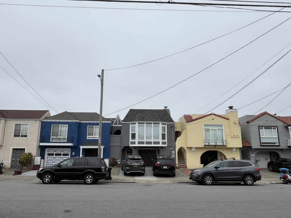
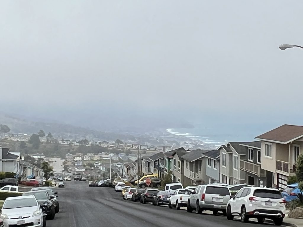
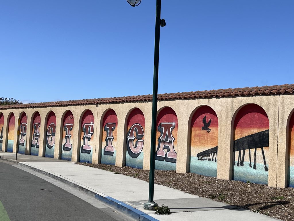
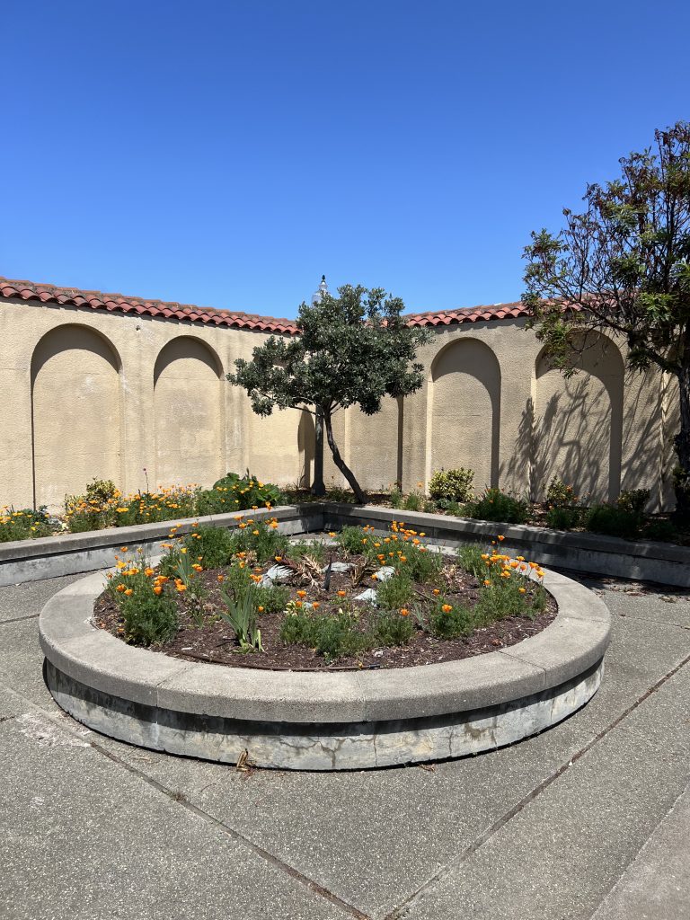
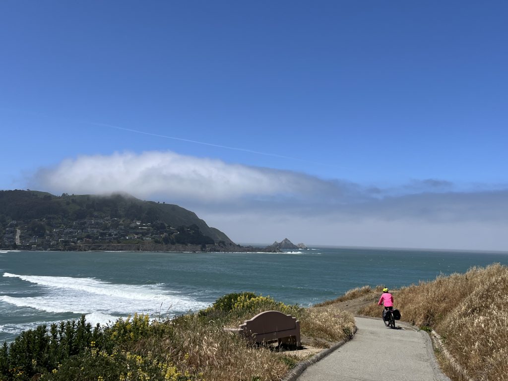
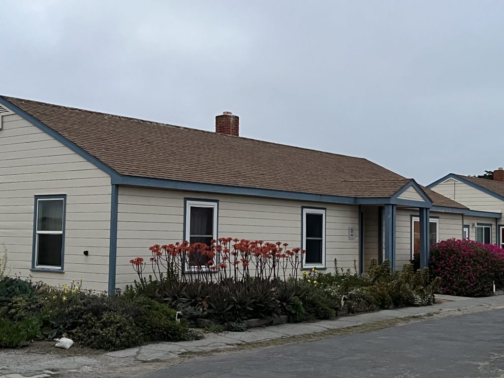
This morning began with waffles, banana and the last of the home made granola from our host in Florence a little while ago. We were on the road at 10, cycling out to the south, largely through residential roads interspersed with large parks and a golf course. Being in a city, space is at more of a premium than we have become used to further north, so the houses were mainly two storeys, and most are painted in bright colours with some built in what looked like a Moorish style – seemingly a San Francisco tradition as we saw it for many miles. The hills are ferocious though – we rode through Daly City and climbed to 650’ above sea level up inclines of at least 10% – and the houses, while still vividly coloured, became single storey once more. At the top we saw the ocean again and whizzed back down from the peak through drifting cloud to sea level in little more than a mile. The wind is strong today, from the west, but seemingly in our faces. Coming in to Pacifica we went through an industrial area with bakeries, the inevitable storage companies and auto shops, before finding a little public seating area with Californian poppies and a few trees but most importantly a wall blocking the wind – a real sun trap. Snack time!
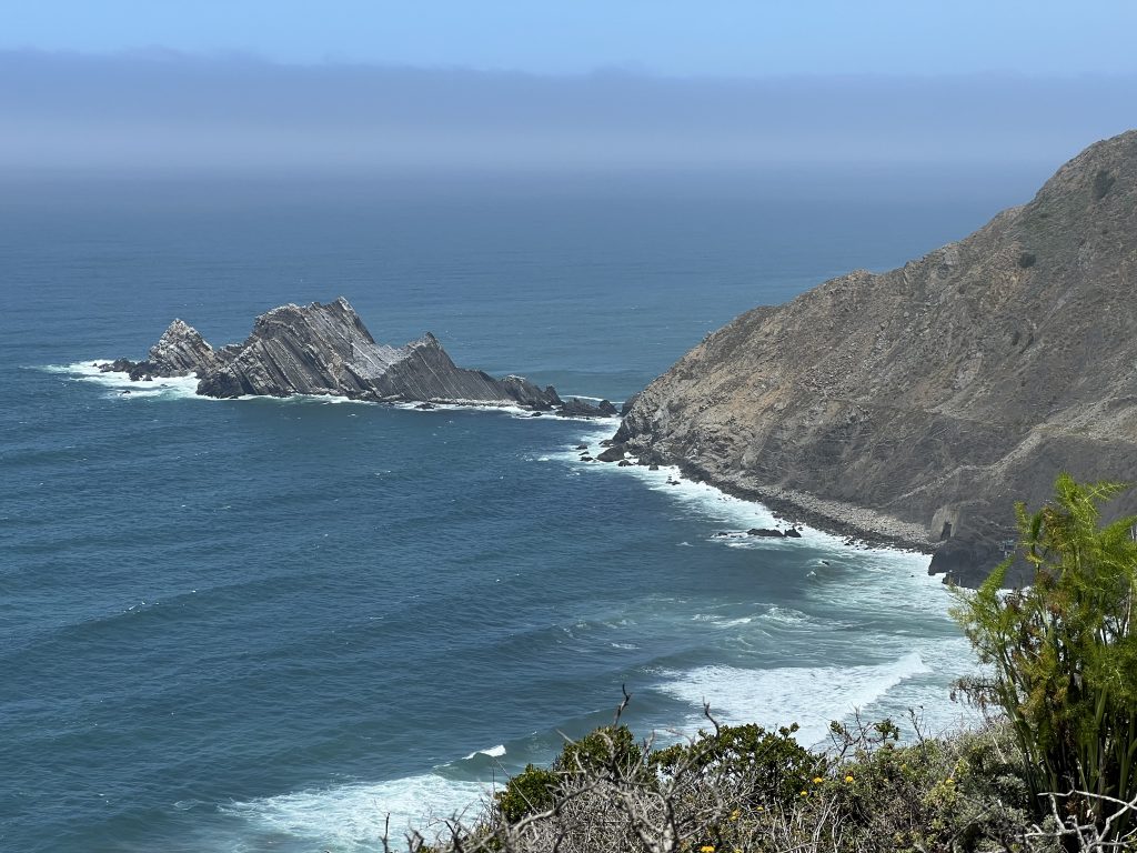
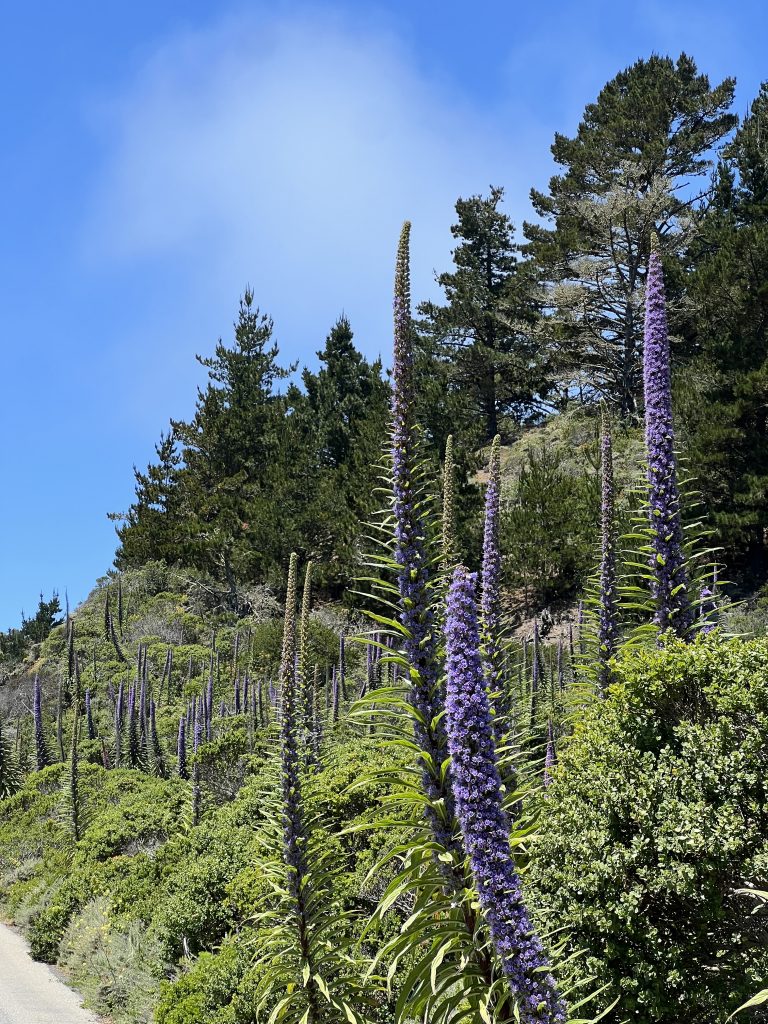
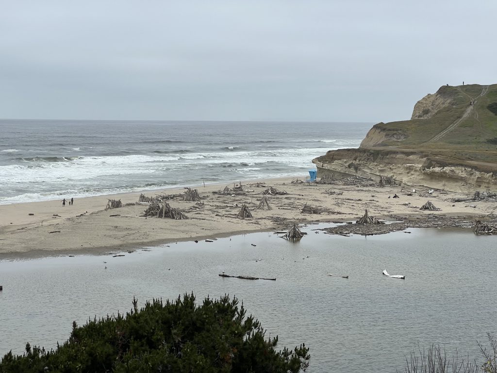
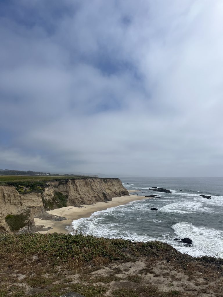
Fairly soon after our stop we came to a lovely beach with crashing waves with several surfers out, and a very chatty Irish lady walking her dog. The trail from the beach was described by the lady as “the switchbacks” and was very tight and hard to navigate. It was a steep climb, and then a gentle descent, past a lovely group of path-side memorial gardens, beautifully maintained, some for individuals and others for events like 9/11. This brought us in to Rockaway Beach – the second town of that name we’ve encountered. We rejoined Highway 1 which all of a sudden went from multiple lanes to one in each direction, winding up through eucalyptus forest before turning towards a tunnel. We were relieved that our route took us off before the tunnel onto a trail through the rolling, green hills, well colonised by towering Tower of Jewels flowers which we call triffids. The trail was the original US 1 before the tunnel was built, and went through interesting geology and up to the Devil’s Slide viewpoint which was very pretty. We stayed at the viewpoint for lunch, and a couple of ladies passed and asked if we’d seen any whales – apparently they were around this morning, and humpback whales are here all year round. We didn’t see any – but thought we saw some seals, and Cathy spotted one take and eat a seagull. Later research suggests that this must have been a sea lion given the feeding behaviour.
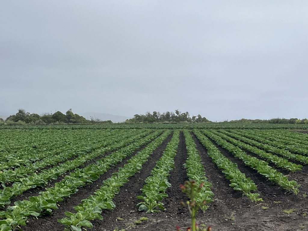
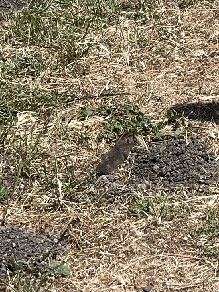
From there we decided we needed to get some miles under our belts so pedalled hard into the wind, back down to sea level. We rode through El Granada and past a county airport with a runway several miles long, and with fields on the other side of the road with precision-planted, perfectly straight, rows of crops. Stopping to use the facilities we spotted a pocket gopher pointing his nose out of a burrow – there was an extensive network showing how effectively these small rodents excavate.
Coming into Half Moon Bay we deviated from Komoot onto another Cathy special trail along the coast, past a curious art studio and through dunes, before rejoining the road and stopping to buy the day’s food – some 21 miles before our destination, but the last grocery store before the coast becomes wilder and less developed.
Leaving Half Moon Bay we alternated between Highway 1 and a cycle trail, then headed out on an unmade track to a headland and found a protected colony of harbor seals, “hauled out” on the rocks, where they spend half their time according to the information board. A very busy little lizard scuttled around our feet, while rabbits ran across the path and a red-tailed hawk got chased off by a small, angry sounding bird.
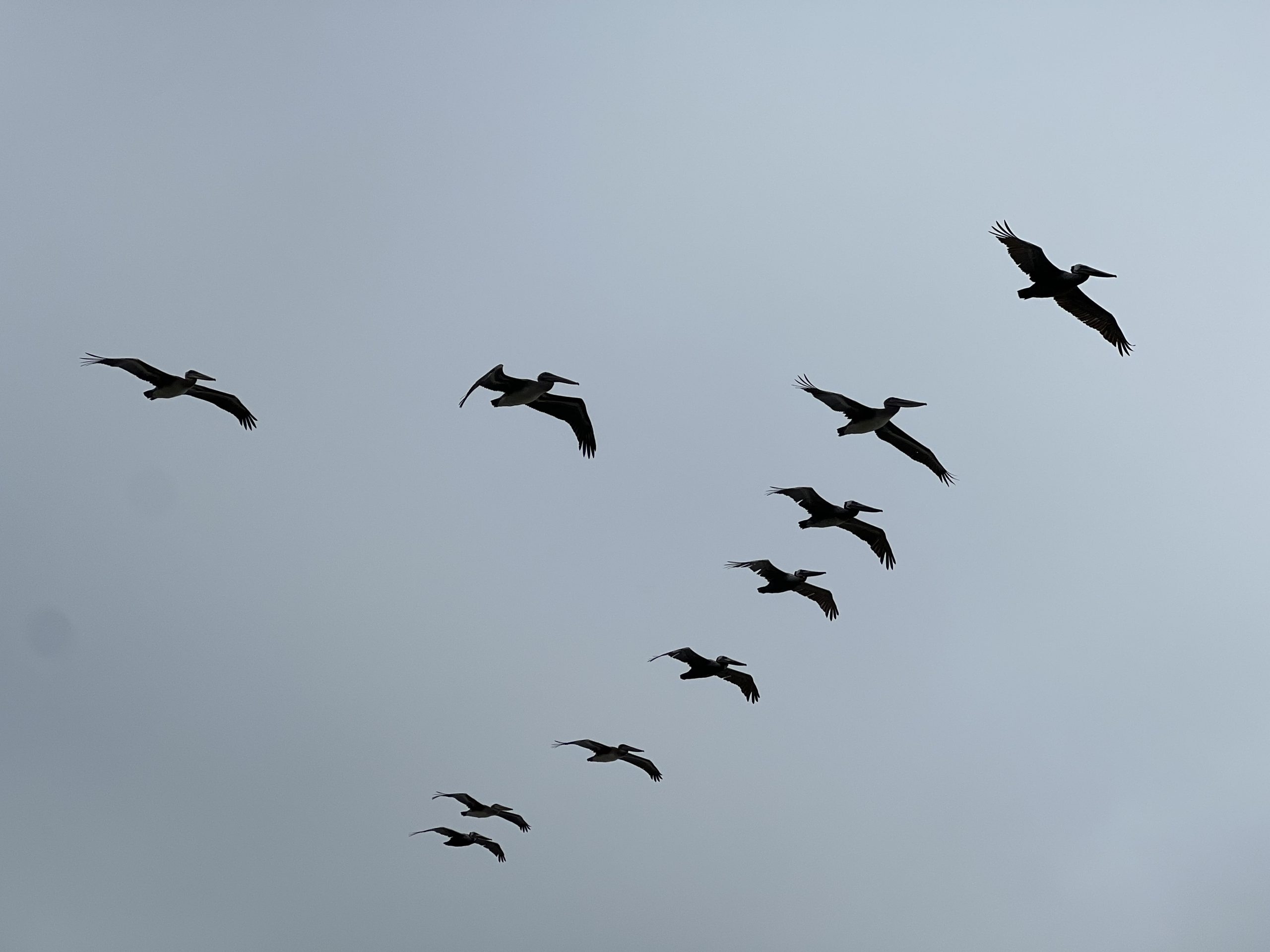
The trail from the headland was amazing – it followed the cliff top and we saw a wonderful squadron of pelicans fly directly overhead, a great white egret, more lizards and rabbits and seals. At one point the trail took us into the Purisima “canyon” with another set of switchbacks – this time on gravel. From there we had 16 miles left, all on Highway 1, and with a perishing cold wind to keep us company but with continuous views of the ocean. We passed many beaches, some well used and some showing pure untouched sand. There were perhaps two houses every mile or so. We all made good use of our motors, minimising the impact of the additional 1,000 feet climbed over that part of the ride.
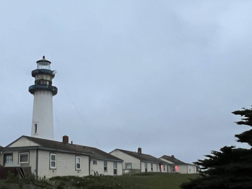
Finally we arrived at Pigeon Point Lighthouse, and the hostel there which is part of the International Hostel Association. As you’d expect, it’s perched on top of a cliff, and the accommodation consists of four keepers’ cottages. We have been fortunate to be given a six-bedded dorm to ourselves, instead of being dispatched to male and female dorms, and we even have our own bathroom and a fabulous view of the ocean, with frequent flypasts from the squadrons of pelicans who live here. It’s a stunning location.
Additional notes
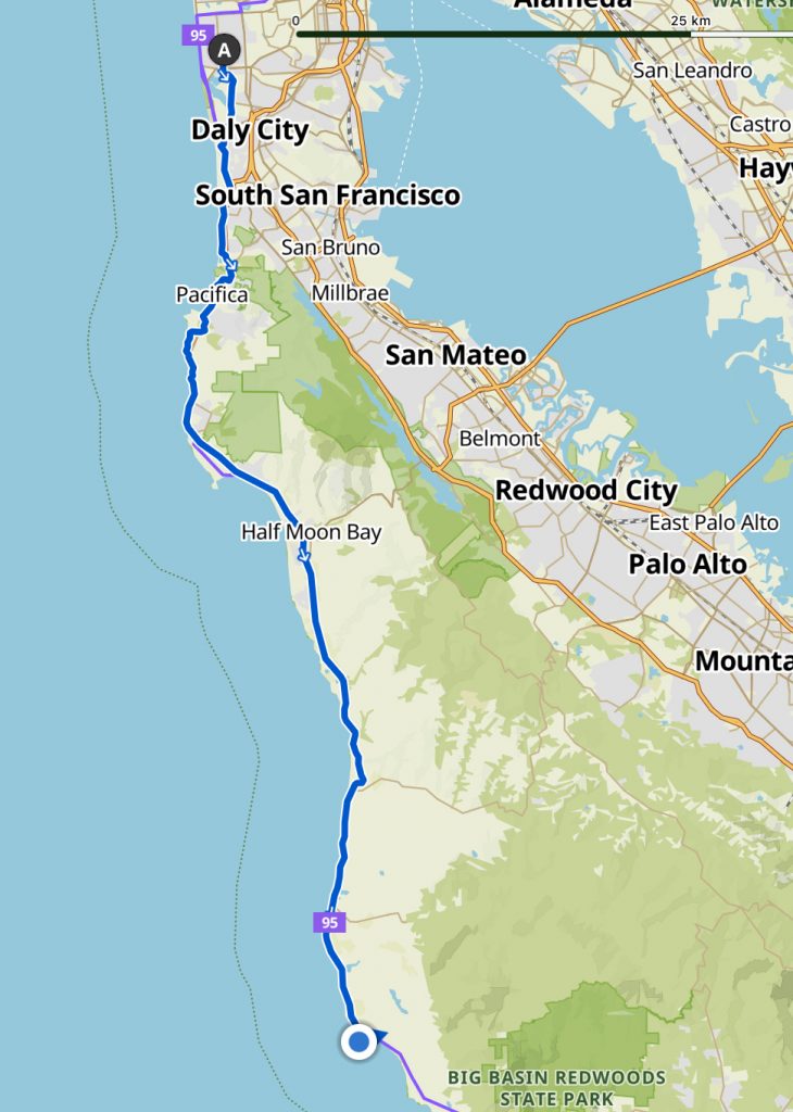
San Francisco to Pigeon Point Lighthouse, San Francisco and San Mateo counties, CA.
Left at 10am. Arrived at 5.45pm.
Weather: Windy and very cold. At times a headwind.
Landscape: Residential streets of San Francisco, all in a grid structure and all either up or down hill. Around Merced Lake. Up and up through residential roads. At the top of the hill there was mist or cloud. Over the crest we got a view of San Francisco and the sea. Pacifica town. The crashing ocean. The beach path. The 1 was busy. Quiet road up to the Devil’s Slide. The 1 beside the ocean. A beach path. Arable land with crops at different stages (the first of what would be many, many fields of crops). Twelve perishingly cold but pleasant miles on the 1 alongside the ocean and beaches to Pigeon Point Lighthouse.
Towns: Pacifica, an attractive, unspoilt seaside town. El Granada. Half Moon Bay.
Trails: Several detours today, not all trails, but they avoided the 1. A lovely beach path with tight zigzags up the hill and down the other side to the next cove, with bad paintings of herons, whales etc attached to posts. The old Highway 1 before the tunnel was built. An ocean path on the far side of the Devil’s Slide. The Cowell-Purisima Trail, a gravel track that led along the cliffs, overlooking coves and through nature reserve habitat.
State roads: The 1 on the other side of Pacifica was busy and the shoulder narrowed to eight inches’ width with a four inch drop off the edge. Funnily enough I don’t recall what the scenery was like at this point (no spare capacity to look anywhere other than at the tarmac in front of my tyres, in my mirror and ahead).
Breakfast: Fruit, yogurt and the last of Bonnie’s granola. Cinnamon waffles.
Lunch spot: At the top of the Devil’s Slide even though we’d done less than 20 miles (Cathy couldn’t believe we were stopping that early in the ride).
Dinner, made by Liz: Sweet potato gratin. Strawberries and yogurt. Tea and carrot cake.
Wildlife: A hummingbird. Sea lions – one that caught and ate a seagull. A pocket gopher. Harbour seals. On the Cowell-Purisima Trail many pelicans and much birdsong. Lizards. Rabbits. Red-tailed hawk. Great white egret. Along the last stretch, a large flock of mixed sea birds rose up from the seashore and flew above us, pelicans and seagulls, almost like a murmuration. Cathy saw hundreds of pelicans flying past in a long line-up at dusk.
Plants: Orange Californian poppies. Wild ceanothus. Eucalyptus forest. Tower of jewels. Yellow lupins. Colourful papery seaside flowers.
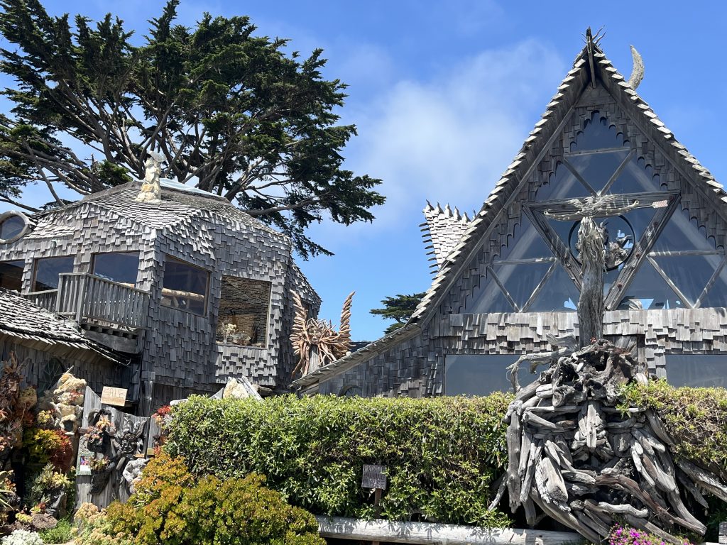
Things we saw: Many nice front gardens – a lot of keen gardeners in San Francisco. The Moorish features early on disappeared, with steps going up to a front door on the first floor. No mailboxes on the street – the postie was walking up to each door. A big mural on the outskirts of Pacifica spelling out the name. Creative shop names in Pacifica like John the Sign Guy and Cotton Crustacean (selling clothes). Numerous surfers near Pacifica. A long row of memorial gardens alongside a trail. The Devil’s Slide geological area beside the ocean, layers of sedimentary rock concertinaed so they ran diagonally, and an island out at sea that matched. A strange building covered in graffiti teetering on a clifftop mound. A small farm with a sign that read ‘Andreotti family farm since 1926’. All the beaches today have been yellow sand, not dark grey volcanic sand.
People we spoke to or saw: Around Merced Lake, quite a few walkers and cyclists, some of whom waved. A man on his driveway waved enthusiastically. An Irish lady walking her dog who’s lived here since the 80s and married a local. At a red light a driver in the car next to us had a chat with us about our bikes. Two ladies on the Devils Slide asked if we’d seen any whales and apologised for their president, and taught us the phrase ‘marine layer’. Kevin the hostel warden was sweet but check-in took ages. Tom and Stephen, also staying at the hostel, heading to Monterey where they will join three others and row to Hawaii.
Incidents: I was upset with Philip after we left the supermarket but we made up on the cliff trail. I chose a complicated dinner 20 miles before arriving at the hostel late and made dinner before I even took off my coat or shoes. Had my shower long after we’d finished eating.
Shopping: Safeway, Half Moon Bay.
Accommodation: Pigeon Point Lighthouse, right out on the point of a headland, the ocean crashing below and many pelicans flying over and past. Very quiet. A six-bedded dorm to ourselves.
Today’s sound: The rustling of the pocket gopher.
Today’s smell: The youth hostel smell.
Special moments: Being out of the city again. The geology for Helen. The hostel being quiet (a surprise, when we booked it I’d imagined it would be bustling). Exploring the headland after dinner.
Positive experience from my journal: All the pelicans.
Appreciation from my journal: Still loving this.
Blog comments from my mother and Helen C. Helen: ‘The pelicans look quite prehistoric flying in formation like that. Well done to keep going through the strong winds and up those hills. Do you ever get off and walk?’
Social media replies from Terry Burridge and Tim Baldwin. Terry: ‘Sounds like the trip of a lifetime’.
Video: San Francisco hilltop view (7s). Pelicans in flight (7s + 14s). Liz, Philip and pelicans (2s). Pocket gopher (1m1s). Small bird (6s). Sea and pelicans at Pigeon Point (10s + 15s).
Mementos: Safeway receipt, Half Moon Bay. Pigeon Point Lighthouse business card.
Leave a Reply